
Live from the National Weather Service

    Storm Center

    Active National Weather Service alerts that matter to a roof — hail, wind, severe thunderstorms, tornadoes, tropical systems and winter storms — with the counties each one names and the office that issued it. Everything below is reproduced as the Weather Service wrote it.

    Further down, in its own lane, the smoke and fire family: fire weather, dense smoke, air quality, blowing dust and volcanic ashfall. Two lists off one feed, kept apart on purpose.

    7 active alerts · read from the National Weather Service at Aug 26, 2:06 AM EDT · refreshed every 10 minutes

    This page is informational and is not a safety resource. It exists to show roofing professionals where storm damage has been reported, and it is refreshed on a ten-minute cycle, so it can lag the Weather Service.

    During an active weather event, the authority is weather.gov and your local emergency management agency. Follow them, not this page.

    National radar

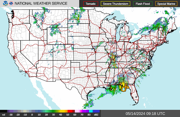
    The National Weather Service's own radar mosaic for the lower 48, served straight from radar.weather.gov and regenerated by NOAA roughly every two minutes.

    NWS radar — the continental United States

    National Weather Service radar for the continental United States, covering the lower 48 states.

    Where precipitation is falling across the continental United States right now. Radar shows precipitation, not damage — a return over a county is not evidence that any particular building was hit.

    Radar imagery: the National Weather Service. Served directly from radar.weather.gov, a free US Government service, and regenerated by NOAA roughly every two minutes — your browser picks up new frames on its own. This site does not process, re-colour or re-time the imagery; it is the Weather Service’s own mosaic, unmodified. weather.gov

    This radar is informational and is not a safety resource. During an active weather event, the authority is weather.gov and your local emergency management agency. Follow them, not this page.

    Forecast wind gusts

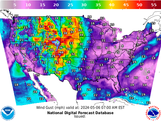
    The National Weather Service's own gust forecast for the lower 48, from the National Digital Forecast Database.

    NWS forecast — forecast wind gusts

    National Weather Service forecast wind gust map for the continental United States, in miles per hour, from the National Digital Forecast Database. A colour-coded map with a speed legend across the top; the forecast valid time and the issue time are printed along the bottom edge of the image.

    Gusts are the wind field that matters to a roof. Uplift on a roof assembly is driven by the peak gust rather than the sustained speed underneath it — a short-lived gust is what gets under a shingle tab, a panel edge or a piece of flashing and starts the progressive failure, and the sustained reading over the same period can be a great deal lower. The Weather Service publishes both fields; this page shows the gust one for that reason and does not show the other.

    This is a forecast valid at the time printed on the image, not an observation and not a report of damage. What is actually in force is the alert list on this page.

    Forecast imagery: the National Weather Service. Served directly from graphical.weather.gov, a free US Government service, and regenerated by NOAA on its own schedule — the forecast valid time and the issue time are printed on the image itself. This site does not process, re-colour or re-time the imagery; it is the Weather Service’s own National Digital Forecast Database graphic, unmodified. weather.gov

    This forecast graphic is informational and is not a safety resource. During an active weather event, the authority is weather.gov and your local emergency management agency. Follow them, not this page.

    Priority markets

    North Carolina, Kansas, Georgia and Illinois — the four states this directory watches most closely.

    Everywhere else

    Every other state carrying an active roof-relevant alert right now, busiest first.

    California

    2 active alerts

    Wind Advisory

    ModerateUrgencyExpectedCertaintyLikely

    Issued by NWS Los Angeles/Oxnard CA

    In effect from Aug 25, 8:37 PM local · until Aug 26, 6:00 AM local

    Counties named in this alert

    • Santa Ynez Mountains Western Range
    Read the full National Weather Service text

    NWS headline

    Wind Advisory issued August 25 at 8:37PM PDT until August 26 at 6:00AM PDT by NWS Los Angeles/Oxnard CA

    NWS description

    * WHAT...For the Wind Advisory, north winds 20 to 30 mph with gusts up to 45 mph. For the Extreme Heat Warning, dangerously hot conditions with high temperatures of 100 to 110 common. * WHERE...Santa Ynez Mountains Western Range. * WHEN...For the Wind Advisory, until 6 AM PDT Wednesday. For the Extreme Heat Warning, until 8 PM PDT Friday. * IMPACTS...There is a high risk for dangerous heat illness, especially for sensitive groups like the very young, the very old, those without air conditioning, and those active outdoors. Gusty winds will blow around unsecured objects. Tree limbs could be blown down and a few power outages may result.

    NWS instructions

    Drink plenty of fluids, stay in an air-conditioned room, stay out of the sun, and check up on relatives and neighbors. Do not leave young children and pets in unattended vehicles. Limit strenuous activities to early morning or evening hours. Take action when you see symptoms of heat exhaustion. Winds this strong can make driving difficult, especially for high profile vehicles. Use extra caution. Secure outdoor objects.

    View this alert on weather.gov

    Wind Advisory

    ModerateUrgencyExpectedCertaintyLikely

    Issued by NWS Los Angeles/Oxnard CA

    In effect from Aug 25, 8:37 PM local · until Aug 26, 6:00 AM local

    Counties named in this alert

    • Santa Barbara County Southwestern Coast
    Read the full National Weather Service text

    NWS headline

    Wind Advisory issued August 25 at 8:37PM PDT until August 26 at 6:00AM PDT by NWS Los Angeles/Oxnard CA

    NWS description

    * WHAT...For the Wind Advisory, North winds 20 to 30 mph with gusts up to 45 mph. For the Extreme Heat Warning, dangerously hot conditions with high temperatures of 92 to 102 common. * WHERE...Santa Barbara County Southwestern Coast. * WHEN...For the Wind Advisory, until 6 AM PDT Wednesday. For the Extreme Heat Warning, until 8 PM PDT Friday. * IMPACTS...There is a high risk for dangerous heat illness, especially for sensitive groups like the very young, the very old, those without air conditioning, and those active outdoors. Gusty winds will blow around unsecured objects. Tree limbs could be blown down and a few power outages may result.

    NWS instructions

    Drink plenty of fluids, stay in an air-conditioned room, stay out of the sun, and check up on relatives and neighbors. Do not leave young children and pets in unattended vehicles. Limit strenuous activities to early morning or evening hours. Take action when you see symptoms of heat exhaustion. Winds this strong can make driving difficult, especially for high profile vehicles. Use extra caution. Secure outdoor objects.

    View this alert on weather.gov

    Nebraska

    2 active alerts

    Special Weather Statement

    ModerateUrgencyExpectedCertaintyObserved

    Issued by NWS Cheyenne WY

    In effect from Aug 25, 11:46 PM local · until Aug 26, 12:30 AM local

    Max hail size0.00Max wind gust55 MPH

    Counties named in this alert

    • Scotts Bluff
    • North Sioux
    • South Sioux
    • East Platte County
    • Goshen County
    Read the full National Weather Service text

    NWS headline

    Special Weather Statement issued August 25 at 11:46PM MDT by NWS Cheyenne WY

    NWS description

    At 1146 PM MDT, Doppler radar was tracking a cluster of strong thunderstorms along a line extending from near Rawhide Buttes to near Lingle. Movement was east at 35 mph. HAZARD...Wind gusts of 50 to 55 mph. SOURCE...Radar indicated. IMPACT...Gusty winds could knock down tree limbs and blow around unsecured objects. Locations impacted include... Torrington, Guernsey, Lingle, Fort Laramie, Henry, Hartville, Register Cliff State Historic Site, Torrington Municipal Airport, Pine Ridge Estates, Prairie Center, Jay Em, Fort Laramie National Historic Site, Southern Hills Estates, Grayrocks Reservoir, Hwy 85 At Dry Rawhide Creek, and Goshen County Fairgrounds.

    NWS instructions

    If outdoors, consider seeking shelter inside a building.

    View this alert on weather.gov

    Special Weather Statement

    ModerateUrgencyExpectedCertaintyObserved

    Issued by NWS Cheyenne WY

    In effect from Aug 25, 11:53 PM local · until Aug 26, 12:45 AM local

    Max hail size0.00Max wind gust50 MPH

    Counties named in this alert

    • Scotts Bluff
    • Banner
    • Central Laramie Range and Southwest Platte County
    • East Platte County
    • Goshen County
    • South Laramie Range
    • South Laramie Range Foothills
    • Central Laramie County
    • East Laramie County
    Read the full National Weather Service text

    NWS headline

    Special Weather Statement issued August 25 at 11:53PM MDT by NWS Cheyenne WY

    NWS description

    At 1153 PM MDT, Doppler radar was tracking gusty showers along a line extending from Veteran to near Table Mountain Ranches. Movement was southeast at 30 mph. HAZARD...Wind gusts up to 50 mph. SOURCE...Radar indicated. IMPACT...Gusty winds could knock down tree limbs and blow around unsecured objects. Locations impacted include... Cheyenne, Mitchell, Morrill, La Grange, Lyman, Happy Valley, Chugwater, Federal, Yoder, Table Mountain Ranches, Willadsen Estates, Rocking Star Ranch, Silver Sage Estates, Granite Canon, Fox Farm-College, Cheyenne Regional Airport, Stegall, Southern Hills Estates, Scotts Bluff County Fairground, and Winchester Hills.

    NWS instructions

    If outdoors, consider seeking shelter inside a building.

    View this alert on weather.gov

    Wyoming

    2 active alerts

    Special Weather Statement

    ModerateUrgencyExpectedCertaintyObserved

    Issued by NWS Cheyenne WY

    In effect from Aug 25, 11:46 PM local · until Aug 26, 12:30 AM local

    Max hail size0.00Max wind gust55 MPH

    Counties named in this alert

    • Scotts Bluff
    • North Sioux
    • South Sioux
    • East Platte County
    • Goshen County
    Read the full National Weather Service text

    NWS headline

    Special Weather Statement issued August 25 at 11:46PM MDT by NWS Cheyenne WY

    NWS description

    At 1146 PM MDT, Doppler radar was tracking a cluster of strong thunderstorms along a line extending from near Rawhide Buttes to near Lingle. Movement was east at 35 mph. HAZARD...Wind gusts of 50 to 55 mph. SOURCE...Radar indicated. IMPACT...Gusty winds could knock down tree limbs and blow around unsecured objects. Locations impacted include... Torrington, Guernsey, Lingle, Fort Laramie, Henry, Hartville, Register Cliff State Historic Site, Torrington Municipal Airport, Pine Ridge Estates, Prairie Center, Jay Em, Fort Laramie National Historic Site, Southern Hills Estates, Grayrocks Reservoir, Hwy 85 At Dry Rawhide Creek, and Goshen County Fairgrounds.

    NWS instructions

    If outdoors, consider seeking shelter inside a building.

    View this alert on weather.gov

    Special Weather Statement

    ModerateUrgencyExpectedCertaintyObserved

    Issued by NWS Cheyenne WY

    In effect from Aug 25, 11:53 PM local · until Aug 26, 12:45 AM local

    Max hail size0.00Max wind gust50 MPH

    Counties named in this alert

    • Scotts Bluff
    • Banner
    • Central Laramie Range and Southwest Platte County
    • East Platte County
    • Goshen County
    • South Laramie Range
    • South Laramie Range Foothills
    • Central Laramie County
    • East Laramie County
    Read the full National Weather Service text

    NWS headline

    Special Weather Statement issued August 25 at 11:53PM MDT by NWS Cheyenne WY

    NWS description

    At 1153 PM MDT, Doppler radar was tracking gusty showers along a line extending from Veteran to near Table Mountain Ranches. Movement was southeast at 30 mph. HAZARD...Wind gusts up to 50 mph. SOURCE...Radar indicated. IMPACT...Gusty winds could knock down tree limbs and blow around unsecured objects. Locations impacted include... Cheyenne, Mitchell, Morrill, La Grange, Lyman, Happy Valley, Chugwater, Federal, Yoder, Table Mountain Ranches, Willadsen Estates, Rocking Star Ranch, Silver Sage Estates, Granite Canon, Fox Farm-College, Cheyenne Regional Airport, Stegall, Southern Hills Estates, Scotts Bluff County Fairground, and Winchester Hills.

    NWS instructions

    If outdoors, consider seeking shelter inside a building.

    View this alert on weather.gov

    Oregon

    1 active alert

    Special Weather Statement

    ModerateUrgencyExpectedCertaintyObserved

    Issued by NWS Pendleton OR

    In effect from Aug 25, 9:27 AM local · until Aug 26, 8:00 PM local

    Counties named in this alert

    • Eastern Columbia River Gorge of Oregon
    • Lower Columbia Basin of Oregon
    • Wallowa County
    • Eastern Columbia River Gorge of Washington
    • Yakima Valley
    • Lower Columbia Basin of Washington
    • Simcoe Highlands
    Read the full National Weather Service text

    NWS headline

    Special Weather Statement issued August 25 at 9:27AM PDT by NWS Pendleton OR

    NWS description

    Winds and relative humidity will reach localized critical fire weather conditions tomorrow, Wednesday between 1100 to 2000 (8PM). While not widespread, this will affect a few of the fires already on the landscape as well as any new fire that may occur in these areas.

    View this alert on weather.gov

    Washington

    1 active alert

    Special Weather Statement

    ModerateUrgencyExpectedCertaintyObserved

    Issued by NWS Pendleton OR

    In effect from Aug 25, 9:27 AM local · until Aug 26, 8:00 PM local

    Counties named in this alert

    • Eastern Columbia River Gorge of Oregon
    • Lower Columbia Basin of Oregon
    • Wallowa County
    • Eastern Columbia River Gorge of Washington
    • Yakima Valley
    • Lower Columbia Basin of Washington
    • Simcoe Highlands
    Read the full National Weather Service text

    NWS headline

    Special Weather Statement issued August 25 at 9:27AM PDT by NWS Pendleton OR

    NWS description

    Winds and relative humidity will reach localized critical fire weather conditions tomorrow, Wednesday between 1100 to 2000 (8PM). While not widespread, this will affect a few of the fires already on the landscape as well as any new fire that may occur in these areas.

    View this alert on weather.gov

    Alaska

    1 active alert

    Special Weather Statement

    ModerateUrgencyExpectedCertaintyObserved

    Issued by NWS Fairbanks AK

    In effect from Aug 25, 1:10 PM local · until Aug 26, 7:00 AM local

    Counties named in this alert

    • Central Brooks Range
    Read the full National Weather Service text

    NWS headline

    Special Weather Statement issued August 25 at 1:10PM AKDT by NWS Fairbanks AK

    NWS description

    Areas of rain on Tuesday will transition to snow in the Eastern Brooks Range Tuesday evening. Snow then continues through the day on Wednesday. Given the rain beforehand, snow will struggle to accumulate immediately but there will be minor accumulations by Wednesday morning. Wednesday afternoon there may be a brief break, allowing snow to gradually melt. Then snow returns Wednesday evening before diminishing into snow showers Thursday morning. Snow totals around 1 to 2 inches are expected overnight Tuesday into Wednesday in the area from Atigun Pass to Sagwon. Snow will continue through the day but struggle to stick due to warmer temperatures and higher sun angle. Wednesday night, another 1 to 2 inches of snow are expected to accumulate before tapering off.

    View this alert on weather.gov

    Hawaii

    1 active alert

    Special Weather Statement

    ModerateUrgencyExpectedCertaintyObserved

    Issued by NWS Honolulu HI

    In effect from Aug 25, 11:25 AM local · until Aug 26, 12:30 AM local

    Counties named in this alert

    • Big Island Interior
    • Big Island Summit
    • Big Island South
    • Big Island Southeast
    • Big Island East
    Read the full National Weather Service text

    NWS headline

    Special Weather Statement issued August 25 at 11:25AM HST by NWS Honolulu HI

    NWS description

    Episode 54 of lava fountaining in Halemaumau began at 10:30 HST this morning. Web cams and radar data indicate that occasional small bursts of volcanic ash continue to emanate from Halemaumau Crater. Low level trade winds will push ash toward the southwest, and any ash fallout will likely occur over the Kau District and Highway 11 southwest of the town of Volcano. This includes the communities of Pahala, Wood Valley, Naalehu and Ocean View. Avoid excessive exposure to ash which is an eye and respiratory irritant. Those with respiratory sensitivities should take extra precaution to minimize exposure.

    View this alert on weather.gov

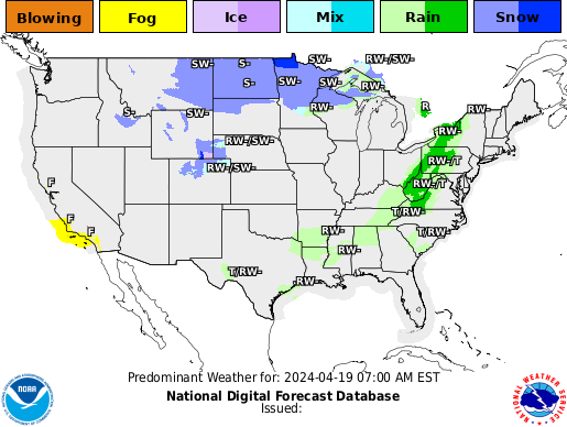
    Predominant weather forecast

    The National Weather Service's forecast of the dominant weather type across the lower 48, from the National Digital Forecast Database.

    NWS forecast — predominant weather

    National Weather Service predominant-weather forecast map for the continental United States, from the National Digital Forecast Database. A colour-coded map with a category legend across the top; the forecast valid time and the issue time are printed along the bottom edge of the image.

    The legend on this map includes a Smoke category alongside the precipitation and severe-weather ones, which makes it the single graphic on this page that shows both of the lanes below and above it at once. Where the Weather Service forecasts smoke to be the predominant weather, it is shaded as smoke.

    It is a forecast valid at the time printed on the image, not an observation. The map is also a visual product with no text equivalent — the authoritative, readable version of what is in force is the two alert lists on this page.

    Forecast imagery: the National Weather Service. Served directly from graphical.weather.gov, a free US Government service, and regenerated by NOAA on its own schedule — the forecast valid time and the issue time are printed on the image itself. This site does not process, re-colour or re-time the imagery; it is the Weather Service’s own National Digital Forecast Database graphic, unmodified. weather.gov

    This forecast graphic is informational and is not a safety resource. During an active weather event, the authority is weather.gov and your local emergency management agency. Follow them, not this page.

    Smoke & fire lane

    Smoke & fire alerts nationwide

    Wildfire smoke, structure fires and blowing dust are what generate smoke-damage losses, and the National Weather Service issues a separate family of alerts for them. This lane reports that family — kept apart from the storm alerts above, because a contractor scanning for hail and somebody working a smoke loss are looking for opposite things in the same feed.

    Alerts describing particulate already in the air are listed ahead of fire-weather forecasts, which is this lane’s own ordering and is stated here so it is not mistaken for a Weather Service ranking. Every card prints its event name and the Weather Service’s own severity grade exactly as issued, wherever it sits in the list.

    19 active smoke or fire alerts · read from the National Weather Service at Aug 26, 2:06 AM EDT · refreshed every 10 minutes

    California

    8 active alerts

    Air Quality Alert

    Air qualityUnknownUrgencyUnknownCertaintyUnknown

    Issued by NWS San Diego CA

    In effect from Aug 24, 1:34 PM local · until Aug 28, 8:00 PM local

    Counties named in this alert

    • San Bernardino and Riverside County Valleys-The Inland Empire
    • San Bernardino County Mountains
    • Coachella Valley
    • San Gorgonio Pass Near Banning
    • Orange County Inland
    Read the full National Weather Service text

    NWS headline

    Air Quality Alert issued August 24 at 1:34PM PDT by NWS San Diego CA

    NWS description

    * WHAT...The South Coast AQMD has issued an air quality alert due to harmful levels of ozone pollution. Visit https://www.aqmd.gov/alertinfo to check current and forecasted air quality levels. * WHERE...in the the South Coast Air Basin and Coachella Valley. Levels of ozone pollution can vary by time and location depending on emissions and air pollution transport. * WHEN...from 1 PM Monday to 8 PM Friday. The highest ozone levels typically occur in the afternoon and early-evening hours. * IMPACTS... Ozone air pollution can cause serious health problems, including trouble breathing, asthma attacks, and lung damage. Everyone can be affected, but sensitive groups such as people with lung disease, older adults, people who are pregnant, children, and those who spend a lot of time outdoors are at greater risk.

    NWS instructions

    To protect your health, check air quality levels and act as needed: * When Air Quality Index (AQI) levels are "Unhealthy for Sensitive Groups" (orange), sensitive groups as specified above should limit extended or intense outdoor activity. * When AQI is "Unhealthy" (red), everyone may experience health impacts. Sensitive groups should avoid extended time outdoors. * When AQI is "Very Unhealthy" (purple), sensitive groups should avoid all outdoor physical activity. Everyone else should avoid extended or intense outdoor activity. * When AQI is "Hazardous" (maroon), everyone should avoid all outdoor physical activity. * ADDITIONAL DETAILS... To help keep indoor air clean when air quality is poor: * Keep windows and doors closed * Run your air conditioner and/or an air purifier * Do not use whole house fans or swamp coolers that bring in outside air if you have other methods to stay cool * Avoid other sources of pollution such as fireplaces, candles, incense, and grilling To help minimize outdoor ozone air pollution levels: * Limit the use of gasoline powered lawn and garden equipment until evening hours * Try to delay trips to the gas station and the use of household chemicals until the evening For the latest air quality forecasts and information, visit the website at aqmd.gov.

    View this alert on weather.gov

    Air Quality Alert

    Air qualityUnknownUrgencyUnknownCertaintyUnknown

    Issued by NWS Los Angeles/Oxnard CA

    In effect from Aug 25, 6:39 AM local · until Aug 28, 8:00 PM local

    Counties named in this alert

    • Eastern San Fernando Valley
    • Eastern San Gabriel Mountains
    • Interstate 5 Corridor
    • Los Angeles County Inland Coast including Downtown Los Angeles
    • Los Angeles County San Gabriel Valley
    • Santa Clarita Valley
    • Santa Susana Mountains
    • Western San Fernando Valley
    • Western San Gabriel Mountains and Highway 14 Corridor
    Read the full National Weather Service text

    NWS headline

    Air Quality Alert issued August 25 at 6:39AM PDT by NWS Los Angeles/Oxnard CA

    NWS description

    * WHAT...The South Coast AQMD has issued an air quality alert due to harmful levels of ozone pollution. Visit https://www.aqmd.gov/alertinfo to check current and forecasted air quality levels. * WHERE...in the the South Coast Air Basin and Coachella Valley. Levels of ozone pollution can vary by time and location depending on emissions and air pollution transport. * WHEN...from 1 PM Monday to 8 PM Friday. The highest ozone levels typically occur in the afternoon and early-evening hours. * IMPACTS... Ozone air pollution can cause serious health problems, including trouble breathing, asthma attacks, and lung damage. Everyone can be affected, but sensitive groups such as people with lung disease, older adults, people who are pregnant, children, and those who spend a lot of time outdoors are at greater risk.

    NWS instructions

    To protect your health, check air quality levels and act as needed: * When Air Quality Index (AQI) levels are "Unhealthy for Sensitive Groups" (orange), sensitive groups as specified above should limit extended or intense outdoor activity. * When AQI is "Unhealthy" (red), everyone may experience health impacts. Sensitive groups should avoid extended time outdoors. * When AQI is "Very Unhealthy" (purple), sensitive groups should avoid all outdoor physical activity. Everyone else should avoid extended or intense outdoor activity. * When AQI is "Hazardous" (maroon), everyone should avoid all outdoor physical activity. * ADDITIONAL DETAILS... To help keep indoor air clean when air quality is poor: * Keep windows and doors closed * Run your air conditioner and/or an air purifier * Do not use whole house fans or swamp coolers that bring in outside air if you have other methods to stay cool * Avoid other sources of pollution such as fireplaces, candles, incense, and grilling To help minimize outdoor ozone air pollution levels: * Limit the use of gasoline powered lawn and garden equipment until evening hours * Try to delay trips to the gas station and the use of household chemicals until the evening

    View this alert on weather.gov

    Air Quality Alert

    Air qualityUnknownUrgencyUnknownCertaintyUnknown

    Issued by NWS Los Angeles/Oxnard CA

    In effect from Aug 25, 7:55 AM local · until Aug 28, 8:00 PM local

    Counties named in this alert

    • Eastern San Fernando Valley
    • Eastern San Gabriel Mountains
    • Interstate 5 Corridor
    • Los Angeles County Inland Coast including Downtown Los Angeles
    • Los Angeles County San Gabriel Valley
    • Santa Clarita Valley
    • Santa Susana Mountains
    • Western San Fernando Valley
    • Western San Gabriel Mountains and Highway 14 Corridor
    Read the full National Weather Service text

    NWS headline

    Air Quality Alert issued August 25 at 7:55AM PDT by NWS Los Angeles/Oxnard CA

    NWS description

    * WHAT...The South Coast AQMD has issued an air quality alert due to harmful levels of ozone pollution. Visit https://www.aqmd.gov/alertinfo to check current and forecasted air quality levels. * WHERE...in the the South Coast Air Basin and Coachella Valley. Levels of ozone pollution can vary by time and location depending on emissions and air pollution transport. * WHEN...from 1 PM Monday to 8 PM Friday. The highest ozone levels typically occur in the afternoon and early-evening hours. * IMPACTS... Ozone air pollution can cause serious health problems, including trouble breathing, asthma attacks, and lung damage. Everyone can be affected, but sensitive groups such as people with lung disease, older adults, people who are pregnant, children, and those who spend a lot of time outdoors are at greater risk.

    NWS instructions

    To protect your health, check air quality levels and act as needed: * When Air Quality Index (AQI) levels are "Unhealthy for Sensitive Groups" (orange), sensitive groups as specified above should limit extended or intense outdoor activity. * When AQI is "Unhealthy" (red), everyone may experience health impacts. Sensitive groups should avoid extended time outdoors. * When AQI is "Very Unhealthy" (purple), sensitive groups should avoid all outdoor physical activity. Everyone else should avoid extended or intense outdoor activity. * When AQI is "Hazardous" (maroon), everyone should avoid all outdoor physical activity. * ADDITIONAL DETAILS... To help keep indoor air clean when air quality is poor: * Keep windows and doors closed * Run your air conditioner and/or an air purifier * Do not use whole house fans or swamp coolers that bring in outside air if you have other methods to stay cool * Avoid other sources of pollution such as fireplaces, candles, incense, and grilling To help minimize outdoor ozone air pollution levels: * Limit the use of gasoline powered lawn and garden equipment until evening hours * Try to delay trips to the gas station and the use of household chemicals until the evening

    View this alert on weather.gov

    Air Quality Alert

    Air qualityUnknownUrgencyUnknownCertaintyUnknown

    Issued by NWS Hanford CA

    In effect from Aug 25, 11:08 AM local · until Aug 27, 11:00 AM local

    Counties named in this alert

    • Merced, CA
    Read the full National Weather Service text

    NWS headline

    Air Quality Alert issued August 25 at 11:08AM PDT by NWS Hanford CA

    NWS description

    Exposure to particle pollution can cause serious health problems; aggravate lung disease, cause asthma attacks and acute bronchitis and increase risk of respiratory infections. In people with heart disease, short-term exposure to particle pollution has been linked to heart attacks and arrhythmias according to the US Environmental Protection Agency. Children and elderly people are also more susceptible to consequences of high particulate levels. Stay indoors if possible. Avoid prolonged or strenuous outdoor physical activities to reduce the affect of unhealthy air. For current air quality go to fire.airnow.gov

    View this alert on weather.gov

    Red Flag Warning

    Fire weatherSevereUrgencyExpectedCertaintyLikely

    Issued by NWS Los Angeles/Oxnard CA

    In effect from Aug 25, 2:57 PM local · until Aug 28, 3:00 PM local

    Counties named in this alert

    • Cuyama Valley
    • San Luis Obispo County Mountains
    • Santa Barbara County Interior Mountains
    • Southern Ventura County Mountains
    • Northern Ventura County Mountains
    • Interstate 5 Corridor
    • Western San Gabriel Mountains and Highway 14 Corridor
    Read the full National Weather Service text

    NWS headline

    Red Flag Warning issued August 25 at 2:57PM PDT until August 28 at 3:00PM PDT by NWS Los Angeles/Oxnard CA

    NWS description

    ...RED FLAG WARNING IN EFFECT THROUGH 3 PM FRIDAY FOR MANY INTERIOR PORTIONS OF SOUTHWEST CALIFORNIA DUE TO EXTREME HEAT AND INSTABILITY ALONG WITH LOCALLY GUSTY WINDS AND LOW HUMIDITIES... .A very hot and unstable air mass combined with locally gusty winds and low humidities will bring a significant risk of large plume dominated fires with rapid spread and extreme fire behavior. * TEMPERATURES...Highs 100 to 110 across the lower mountains, adjacent foothills and the Cuyama Valley, and 85 to 95 across higher mountains. Lows in the mid 70s to mid 80s common in the mountains and foothills. * INSTABILITY...Very deep mixing heights of 12,000 to 20,000 feet today through Thursday, slightly lower on Friday. * WINDS...Local northwest to north winds 15 to 25 mph with gusts up to 35 mph at times, strongest across the I-5 and Highway 33 corridors. A slightly stronger northerly wind push is possible late Thursday night into Friday morning, with gusts up to 40 mph possible across the I-5 corridor. * RELATIVE HUMIDITY...Minimum humidities 10 to 20 percent each day, with isolated values as low as 7 percent Wednesday through Friday. Poor recoveries overnight hours in the mountains and foothills with humidities in the 15 to 30 percent range. * IMPACTS...There is a significant risk of large plume dominated fires with rapid fire spread and extreme fire behavior. There is a history of large plume dominated fires this time of year with similar weather and fuel conditions, including the Bridge, Bobcat, and Station fires.

    NWS instructions

    A Red Flag Warning means that critical fire weather conditions will occur shortly. Use extreme caution with anything that can spark a wildfire. Residents near wildland interfaces should be prepared to evacuate if a wildfire breaks out. See readyforwildfire.org and wildfirerisk.org for information.

    View this alert on weather.gov

    Red Flag Warning

    Fire weatherSevereUrgencyExpectedCertaintyLikely

    Issued by NWS Los Angeles/Oxnard CA

    In effect from Aug 25, 2:57 PM local · until Aug 28, 3:00 PM local

    Counties named in this alert

    • Santa Susana Mountains
    • Eastern San Gabriel Mountains
    Read the full National Weather Service text

    NWS headline

    Red Flag Warning issued August 25 at 2:57PM PDT until August 28 at 3:00PM PDT by NWS Los Angeles/Oxnard CA

    NWS description

    ...RED FLAG WARNING IN EFFECT THROUGH 3 PM FRIDAY FOR MANY INTERIOR PORTIONS OF SOUTHWEST CALIFORNIA DUE TO EXTREME HEAT AND INSTABILITY ALONG WITH LOCALLY GUSTY WINDS AND LOW HUMIDITIES... .A very hot and unstable air mass combined with locally gusty winds and low humidities will bring a significant risk of large plume dominated fires with rapid spread and extreme fire behavior. * TEMPERATURES...Highs 96 to 106 across the lower elevations. Highs 85 to 95 common across the higher mountains. Lows in the mid 70s to mid 80s common in the mountains and foothills. * INSTABILITY...Very deep mixing heights of 12,000 to 18,000 feet today through Thursday, slightly lower on Friday. * WINDS...Southwest 10 to 20 mph with gusts 20 to 30 mph each afternoon into early evening. * RELATIVE HUMIDITY...Minimum humidities 10 to 20 percent each day, Poor recoveries overnight hours in the mountains and foothills with humidities in the 15 to 30 percent range. * IMPACTS...There is a significant risk of large plume dominated fires with rapid fire spread and extreme fire behavior. There is a history of large plume dominated fires this time of year with similar weather and fuel conditions, including the Bridge, Bobcat, and Station fires.

    NWS instructions

    A Red Flag Warning means that critical fire weather conditions will occur shortly. Use extreme caution with anything that can spark a wildfire. Residents near wildland interfaces should be prepared to evacuate if a wildfire breaks out. See readyforwildfire.org and wildfirerisk.org for information.

    View this alert on weather.gov

    Red Flag Warning

    Fire weatherSevereUrgencyExpectedCertaintyLikely

    Issued by NWS Medford OR

    In effect from Aug 26, 11:00 AM local · until Aug 26, 8:00 PM local

    Counties named in this alert

    • Modoc County Except for the Surprise Valley
    • Klamath Basin and the Fremont-Winema National Forest
    • South Central Oregon Desert including the BLM Land in Eastern Lake and Western Harney Counties
    Read the full National Weather Service text

    NWS headline

    Red Flag Warning issued August 25 at 5:32PM PDT until August 26 at 8:00PM PDT by NWS Medford OR

    NWS description

    ...FIRE WEATHER WATCH REMAINS IN EFFECT FROM THURSDAY MORNING THROUGH THURSDAY EVENING FOR STRONG GUSTY WIND AND LOW RH FOR FIRE WEATHER ZONES 285, 624, AND 625... * IMPACTS...Any fires that develop will likely spread rapidly. * AFFECTED AREA...In California...Fire weather zone 285. In Oregon...Fire weather zone 624, mainly from around the Wright's Spring Fire and Bonanza eastward...and all of fire weather zone 625. * WIND...South to southwest at 15 to 25 mph with gusts of 30 to 40 mph both days. * HUMIDITY...Daytime humidities down around 9 to 15 percent both days. * DETAILED URL...View the hazard area in detail at https://weather.gov/wrh/hazards?wfo=mfr

    NWS instructions

    Follow all fire restrictions. You can find your county's emergency sign up form as well as links to fire restrictions at weather.gov/medford/wildfire. One less spark, one less wildfire. Be sure you're signed up for your county's emergency alert system. Familiarize yourself with your emergency plan and make sure you listen to emergency services. Visit ready.gov/plan for more information. A Red Flag Warning is issued when we identify weather conditions that promote rapid spread of fire which may become life- threatening. This does not mean there is a fire. These conditions are either occurring now or will begin soon. It is important to have multiple ways to receive information from authorities. If you have not packet your go kit yet, now is the time to do so. This includes items like important documents and essentials you cannot live without. Fill your vehicle's fuel tank. Visit ready.gov/kit for more information.

    View this alert on weather.gov

    Fire Weather Watch

    Fire weatherSevereUrgencyFutureCertaintyPossible

    Issued by NWS Medford OR

    In effect from Aug 27, 11:00 AM local · until Aug 27, 8:00 PM local

    Counties named in this alert

    • Modoc County Except for the Surprise Valley
    • Klamath Basin and the Fremont-Winema National Forest
    • South Central Oregon Desert including the BLM Land in Eastern Lake and Western Harney Counties
    Read the full National Weather Service text

    NWS headline

    Fire Weather Watch issued August 25 at 5:32PM PDT until August 27 at 8:00PM PDT by NWS Medford OR

    NWS description

    ...FIRE WEATHER WATCH REMAINS IN EFFECT FROM THURSDAY MORNING THROUGH THURSDAY EVENING FOR STRONG GUSTY WIND AND LOW RH FOR FIRE WEATHER ZONES 285, 624, AND 625... * IMPACTS...Any fires that develop will likely spread rapidly. * AFFECTED AREA...In California...Fire weather zone 285. In Oregon...Fire weather zone 624, mainly from around the Wright's Spring Fire and Bonanza eastward...and all of fire weather zone 625. * WIND...South to southwest at 15 to 25 mph with gusts of 30 to 40 mph both days. * HUMIDITY...Daytime humidities down around 9 to 15 percent both days. * DETAILED URL...View the hazard area in detail at https://weather.gov/wrh/hazards?wfo=mfr

    NWS instructions

    Follow all fire restrictions. You can find your county's emergency sign up form as well as links to fire restrictions at weather.gov/medford/wildfire. One less spark, one less wildfire. Be sure you're signed up for your county's emergency alert system. Familiarize yourself with your emergency plan and make sure you listen to emergency services. Visit ready.gov/plan for more information. A Red Flag Warning is issued when we identify weather conditions that promote rapid spread of fire which may become life- threatening. This does not mean there is a fire. These conditions are either occurring now or will begin soon. It is important to have multiple ways to receive information from authorities. If you have not packet your go kit yet, now is the time to do so. This includes items like important documents and essentials you cannot live without. Fill your vehicle's fuel tank. Visit ready.gov/kit for more information.

    View this alert on weather.gov

    Oregon

    6 active alerts

    Air Quality Alert

    Air qualityUnknownUrgencyUnknownCertaintyUnknown

    Issued by NWS Boise ID

    In effect from Aug 24, 11:09 AM local · until Aug 26, 1:00 PM local

    Counties named in this alert

    • Baker, OR
    Read the full National Weather Service text

    NWS headline

    Air Quality Alert issued August 24 at 11:09AM MDT by NWS Boise ID

    NWS description

    * WHAT...High concentration of smoke particulates from wildfire smoke. * WHERE...Baker County. * WHEN...UNTIL NOON PDT WEDNESDAY. * IMPACTS...Smoke can irritate the eyes, lungs and worsen some medical conditions. People most at risk to adverse health effects include infants, young children, people with heart or lung disease, older adults, and pregnant women. * ADDITIONAL DETAILS...Smoke levels can change rapidly depending on weather. Check current conditions on the Oregon Smoke Information Blog, DEQ's Air Quality Index, or by downloading the free OregonAIR app on your smartphone.

    NWS instructions

    * Stay inside if possible. Keep windows and doors closed. * Avoid strenuous outdoor activity. * Use high efficiency particulate air (HEPA) filters in indoor ventilation systems or portable air purifiers. * Be aware of smoke in your area and avoid places with the highest levels. * If you have heart or lung disease, or asthma, follow your healthcare provider's advice. For current Oregon air quality conditions, please visit: https://aqi.oregon.gov For additional information, please visit: https://www.oregon.gov/deq

    View this alert on weather.gov

    Air Quality Alert

    Air qualityUnknownUrgencyUnknownCertaintyUnknown

    Issued by NWS Pendleton OR

    In effect from Aug 25, 12:14 PM local · until Aug 26, 12:15 PM local

    Counties named in this alert

    • Umatilla, OR
    Read the full National Weather Service text

    NWS headline

    Air Quality Alert issued August 25 at 12:14PM PDT by NWS Pendleton OR

    NWS description

    Oregon Department of Environmental Quality has issued an Air Quality Advisory until noon PDT Wednesday. For the Air Quality Advisory, stagnant air conditions will trap smoke and other air pollutants near the ground where people breathe. Check with your local health or air agency for current restrictions on woodstove use. There are often exceptions for those who use wood exclusively to heat their homes and those with limited income. People can take the following precautions to protect their health: * Follow local burn restrictions to prevent deteriorating air quality. * Avoid strenuous outdoor activity in smoky conditions. * People with heart or lung problems and young children are especially vulnerable. These people should stay indoors while smoke levels are high. * Use certified High Efficiency Particulate Air (HEPA) filters in indoor heating ventilation, cooling, and air purification systems. * Avoid using wood-burning stoves and other sources of indoor smoke if possible. For additional information...please visit the Web site at http://www.oregon.gov/DEQ

    View this alert on weather.gov

    Air Quality Alert

    Air qualityUnknownUrgencyUnknownCertaintyUnknown

    Issued by NWS Pendleton OR

    In effect from Aug 25, 12:39 PM local · until Aug 26, 12:00 PM local

    Counties named in this alert

    • Umatilla, OR
    Read the full National Weather Service text

    NWS headline

    Air Quality Alert issued August 25 at 12:39PM PDT by NWS Pendleton OR

    NWS description

    Oregon Department of Environmental Quality has issued an Air Quality Advisory until noon PDT Wednesday. For the Smoke Air Quality Advisory, wildfires burning in the region combined with forecasted conditions will cause air quality to reach unhealthy levels. Pollutants in smoke can cause burning eyes, runny nose, aggravate heart and lung diseases, and aggravate other serious health problems. Limit outdoor activities and keep children indoors if it is smoky. Please follow medical advice if you have a heart or lung condition. For additional information...please visit the Web site at http://www.oregon.gov/DEQ

    View this alert on weather.gov

    Red Flag Warning

    Fire weatherSevereUrgencyExpectedCertaintyLikely

    Issued by NWS Medford OR

    In effect from Aug 26, 11:00 AM local · until Aug 26, 8:00 PM local

    Counties named in this alert

    • Modoc County Except for the Surprise Valley
    • Klamath Basin and the Fremont-Winema National Forest
    • South Central Oregon Desert including the BLM Land in Eastern Lake and Western Harney Counties
    Read the full National Weather Service text

    NWS headline

    Red Flag Warning issued August 25 at 5:32PM PDT until August 26 at 8:00PM PDT by NWS Medford OR

    NWS description

    ...FIRE WEATHER WATCH REMAINS IN EFFECT FROM THURSDAY MORNING THROUGH THURSDAY EVENING FOR STRONG GUSTY WIND AND LOW RH FOR FIRE WEATHER ZONES 285, 624, AND 625... * IMPACTS...Any fires that develop will likely spread rapidly. * AFFECTED AREA...In California...Fire weather zone 285. In Oregon...Fire weather zone 624, mainly from around the Wright's Spring Fire and Bonanza eastward...and all of fire weather zone 625. * WIND...South to southwest at 15 to 25 mph with gusts of 30 to 40 mph both days. * HUMIDITY...Daytime humidities down around 9 to 15 percent both days. * DETAILED URL...View the hazard area in detail at https://weather.gov/wrh/hazards?wfo=mfr

    NWS instructions

    Follow all fire restrictions. You can find your county's emergency sign up form as well as links to fire restrictions at weather.gov/medford/wildfire. One less spark, one less wildfire. Be sure you're signed up for your county's emergency alert system. Familiarize yourself with your emergency plan and make sure you listen to emergency services. Visit ready.gov/plan for more information. A Red Flag Warning is issued when we identify weather conditions that promote rapid spread of fire which may become life- threatening. This does not mean there is a fire. These conditions are either occurring now or will begin soon. It is important to have multiple ways to receive information from authorities. If you have not packet your go kit yet, now is the time to do so. This includes items like important documents and essentials you cannot live without. Fill your vehicle's fuel tank. Visit ready.gov/kit for more information.

    View this alert on weather.gov

    Fire Weather Watch

    Fire weatherSevereUrgencyFutureCertaintyPossible

    Issued by NWS Medford OR

    In effect from Aug 27, 11:00 AM local · until Aug 27, 8:00 PM local

    Counties named in this alert

    • Modoc County Except for the Surprise Valley
    • Klamath Basin and the Fremont-Winema National Forest
    • South Central Oregon Desert including the BLM Land in Eastern Lake and Western Harney Counties
    Read the full National Weather Service text

    NWS headline

    Fire Weather Watch issued August 25 at 5:32PM PDT until August 27 at 8:00PM PDT by NWS Medford OR

    NWS description

    ...FIRE WEATHER WATCH REMAINS IN EFFECT FROM THURSDAY MORNING THROUGH THURSDAY EVENING FOR STRONG GUSTY WIND AND LOW RH FOR FIRE WEATHER ZONES 285, 624, AND 625... * IMPACTS...Any fires that develop will likely spread rapidly. * AFFECTED AREA...In California...Fire weather zone 285. In Oregon...Fire weather zone 624, mainly from around the Wright's Spring Fire and Bonanza eastward...and all of fire weather zone 625. * WIND...South to southwest at 15 to 25 mph with gusts of 30 to 40 mph both days. * HUMIDITY...Daytime humidities down around 9 to 15 percent both days. * DETAILED URL...View the hazard area in detail at https://weather.gov/wrh/hazards?wfo=mfr

    NWS instructions

    Follow all fire restrictions. You can find your county's emergency sign up form as well as links to fire restrictions at weather.gov/medford/wildfire. One less spark, one less wildfire. Be sure you're signed up for your county's emergency alert system. Familiarize yourself with your emergency plan and make sure you listen to emergency services. Visit ready.gov/plan for more information. A Red Flag Warning is issued when we identify weather conditions that promote rapid spread of fire which may become life- threatening. This does not mean there is a fire. These conditions are either occurring now or will begin soon. It is important to have multiple ways to receive information from authorities. If you have not packet your go kit yet, now is the time to do so. This includes items like important documents and essentials you cannot live without. Fill your vehicle's fuel tank. Visit ready.gov/kit for more information.

    View this alert on weather.gov

    Fire Weather Watch

    Fire weatherSevereUrgencyFutureCertaintyPossible

    Issued by NWS Boise ID

    In effect from Aug 27, 12:00 PM local · until Aug 27, 9:00 PM local

    Counties named in this alert

    • Owyhee Mountains
    • Burns BLM
    • Steens Mountain
    • Southern Grasslands
    Read the full National Weather Service text

    NWS headline

    Fire Weather Watch issued August 25 at 1:37PM MDT until August 27 at 9:00PM MDT by NWS Boise ID

    NWS description

    The National Weather Service in Boise has issued a Fire Weather Watch for winds and low relative humidities, which is in effect from Thursday afternoon through Thursday evening. * AFFECTED AREA...In Idaho, Fire Weather Zone 423 Owyhee Mountains. In Oregon, Fire Weather Zones 670 Burns BLM, 671 Steens Mountain and 672 Southern Grasslands. * TIMING...From Thursday afternoon through Thursday evening. * WINDS...Southwest 10 to 25 mph with gusts up to 40 mph. * RELATIVE HUMIDITY...9 to 19 percent. * TEMPERATURES...85 to 93 degrees. * IMPACTS...Any fire that develops will catch and spread quickly. Outdoor burning is not recommended.

    NWS instructions

    A Fire Weather Watch means that critical fire weather conditions are possible. Listen for later forecasts and possible Red Flag Warnings.

    View this alert on weather.gov

    Washington

    4 active alerts

    Air Quality Alert

    Air qualityUnknownUrgencyUnknownCertaintyUnknown

    Issued by NWS Spokane WA

    In effect from Aug 25, 10:51 AM local · until Aug 26, 12:00 PM local

    Counties named in this alert

    • Chelan, WA
    • Douglas, WA
    • Okanogan, WA
    Read the full National Weather Service text

    NWS headline

    Air Quality Alert issued August 25 at 10:51AM PDT by NWS Spokane WA

    NWS description

    An Air Quality Alert has been issued by the following agencies: Washington Department of Ecology An Air Quality Alert has been issued for Chelan, Douglas, and Okanogan Counties until further notice due to current and expected smoke from regional fires. Particulate matter (PM2.5) may reach Unhealthy levels for areas downwind from active wildfires. Be sure to check air monitors in your area before outdoor activities. When air quality is Unhealthy, everyone should reduce exposure. Limit time outside, avoid strenuous outdoor activity, and follow tips for cleaner indoor air.

    View this alert on weather.gov

    Air Quality Alert

    Air qualityUnknownUrgencyUnknownCertaintyUnknown

    Issued by NWS Pendleton OR

    In effect from Aug 25, 12:14 PM local · until Aug 26, 12:15 PM local

    Counties named in this alert

    • Kittitas, WA
    • Walla Walla, WA
    Read the full National Weather Service text

    NWS headline

    Air Quality Alert issued August 25 at 12:14PM PDT by NWS Pendleton OR

    NWS description

    The Washington State Department of Ecology, Benton Clean Air Agency, and the Yakima Regional Clean Air Agency have issued an Air Quality Alert until noon PDT Wednesday. For the Air Quality Alert, stagnant air conditions will trap smoke and other air pollutants near the ground where people breathe. Check with your local health or air agency for current restrictions on woodstove use. There are often exceptions for those who use wood exclusively to heat their homes and those with limited income. People can take the following precautions to protect their health: * Follow local burn restrictions to prevent deteriorating air quality. * Avoid strenuous outdoor activity in smoky conditions. * People with heart or lung problems and young children are especially vulnerable. These people should stay indoors while smoke levels are high. * Use certified High Efficiency Particulate Air (HEPA) filters in indoor heating ventilation, cooling, and air purification systems. * Avoid using wood-burning stoves and other sources of indoor smoke if possible. Information from the Washington Department of Ecology web site is available at http://www.ecy.wa.gov/air.html or call 360-407-6000. Information from the Yakima Regional Clean Air Agency web site is available at http://www.yakimacleanair.org or call 509-834-2050. Information from the Benton County Clean Air Agency web site is available at http://www.bentoncleanair.org or call 509-783-1304.

    View this alert on weather.gov

    Air Quality Alert

    Air qualityUnknownUrgencyUnknownCertaintyUnknown

    Issued by NWS Pendleton OR

    In effect from Aug 25, 12:39 PM local · until Aug 26, 12:00 PM local

    Counties named in this alert

    • Kittitas, WA
    • Walla Walla, WA
    Read the full National Weather Service text

    NWS headline

    Air Quality Alert issued August 25 at 12:39PM PDT by NWS Pendleton OR

    NWS description

    The Washington State Department of Ecology has issued an Air Quality Alert until noon PDT Wednesday. An Air Quality Alert has been issued for Kittitas and Walla Walla Counties through Wednesday August 26 at noon due to current and expected wildfire smoke from regional fires. Particulate matter (PM2.5) may reach Unhealthy to Sensitive Groups to Unhealthy levels for areas directly downwind from active fires, especially overnight and during the early morning hours. Be sure to check air monitors in your area before outdoor activities. When air quality is Unhealthy, everyone should reduce exposure. Limit time outside, avoid, strenuous outdoor activity, and follow tips for cleaner indoor air. Information from the Washington Department of Ecology web site is available at http://www.ecy.wa.gov/air.html or call 360-407-6000.

    View this alert on weather.gov

    Fire Weather Watch

    Fire weatherSevereUrgencyFutureCertaintyPossible

    Issued by NWS Spokane WA

    In effect from Aug 27, 12:00 PM local · until Aug 27, 8:00 PM local

    Counties named in this alert

    • Okanogan Valley
    • Waterville Plateau
    Read the full National Weather Service text

    NWS headline

    Fire Weather Watch issued August 25 at 10:39AM PDT until August 27 at 8:00PM PDT by NWS Spokane WA

    NWS description

    The National Weather Service in Spokane has issued a Fire Weather Watch for wind and low relative humidity, which is in effect from Thursday afternoon through Thursday evening. * Affected Area: Okanogan Valley (Zone 703) and Waterville Plateau (Zone 706). * Winds: Southwest 15 to 25 mph with gusts up to 35 mph. * Relative Humidities: 19 to 25 percent. * Impacts: Rapid fire spread is possible with any new or ongoing fires.

    NWS instructions

    A Fire Weather Watch means that critical fire weather conditions are forecast to occur. Listen for later forecasts and possible Red Flag Warnings.

    View this alert on weather.gov

    Idaho

    2 active alerts

    Red Flag Warning

    Fire weatherSevereUrgencyExpectedCertaintyLikely

    Issued by NWS Missoula MT

    In effect from Aug 26, 12:00 PM local · until Aug 26, 8:00 PM local

    Counties named in this alert

    • Palouse/Nezperce Reservation/Hells Canyon Region
    Read the full National Weather Service text

    NWS headline

    Red Flag Warning issued August 25 at 1:07PM MDT until August 26 at 8:00PM MDT by NWS Missoula MT

    NWS description

    ...RED FLAG WARNING IN EFFECT FROM 11 AM TO 7 PM PDT WEDNESDAY DUE TO WIND AND LOW RELATIVE HUMIDITY FOR PALOUSE/HELLS CANYON... The National Weather Service in Missoula MT has issued a Red Flag Warning. * AFFECTED AREA...Fire Weather Zone 102. The drier and windier areas will be locations along and south of Highway 12. * TIMING...From 11 AM to 7 PM PDT Wednesday. * WINDS...Southwest winds 15 to 20 mph with gusts 30 to 35 mph. * RELATIVE HUMIDITY...Relative Humidity between 10 to 15 percent. * IMPACTS...Any fires that develop will spread rapidly. Outdoor burning is not recommended.

    NWS instructions

    Please advise the appropriate officials or fire crews in the field of this Red Flag Warning.

    View this alert on weather.gov

    Fire Weather Watch

    Fire weatherSevereUrgencyFutureCertaintyPossible

    Issued by NWS Boise ID

    In effect from Aug 27, 12:00 PM local · until Aug 27, 9:00 PM local

    Counties named in this alert

    • Owyhee Mountains
    • Burns BLM
    • Steens Mountain
    • Southern Grasslands
    Read the full National Weather Service text

    NWS headline

    Fire Weather Watch issued August 25 at 1:37PM MDT until August 27 at 9:00PM MDT by NWS Boise ID

    NWS description

    The National Weather Service in Boise has issued a Fire Weather Watch for winds and low relative humidities, which is in effect from Thursday afternoon through Thursday evening. * AFFECTED AREA...In Idaho, Fire Weather Zone 423 Owyhee Mountains. In Oregon, Fire Weather Zones 670 Burns BLM, 671 Steens Mountain and 672 Southern Grasslands. * TIMING...From Thursday afternoon through Thursday evening. * WINDS...Southwest 10 to 25 mph with gusts up to 40 mph. * RELATIVE HUMIDITY...9 to 19 percent. * TEMPERATURES...85 to 93 degrees. * IMPACTS...Any fire that develops will catch and spread quickly. Outdoor burning is not recommended.

    NWS instructions

    A Fire Weather Watch means that critical fire weather conditions are possible. Listen for later forecasts and possible Red Flag Warnings.

    View this alert on weather.gov

    Arizona

    1 active alert

    Air Quality Alert

    Air qualityUnknownUrgencyUnknownCertaintyUnknown

    Issued by NWS Phoenix AZ

    In effect from Aug 25, 9:17 AM local · until Aug 26, 9:00 PM local

    Counties named in this alert

    • Maricopa, AZ
    Read the full National Weather Service text

    NWS headline

    Air Quality Alert issued August 25 at 9:17AM MST by NWS Phoenix AZ

    NWS description

    AQAPSR The Arizona Department of Environmental Quality (ADEQ) has extended an Ozone High Pollution Advisory for the Phoenix Metro Area through Wednesday. This means that forecast weather conditions combined with existing ozone levels are expected to result in local maximum 8-hour ozone concentrations that pose a health risk. Adverse health effects increase as air quality deteriorates. Ozone is an air contaminant which can cause breathing difficulties for children, older adults, as well as persons with respiratory problems. A decrease in physical activity is recommended. You are urged to car pool, telecommute or use mass transit. The use of gasoline-powered equipment should be reduced or done late in the day. For details on this High Pollution Advisory, visit the ADEQ internet site at www.azdeq.gov/forecast/phoenix or call 602-771-2300.

    View this alert on weather.gov

    Texas

    1 active alert

    Air Quality Alert

    Air qualityUnknownUrgencyUnknownCertaintyUnknown

    Issued by NWS Fort Worth TX

    In effect from Aug 25, 2:35 PM local · until Aug 26, 6:00 PM local

    Counties named in this alert

    • Wise
    • Denton
    • Collin
    • Hunt
    • Parker
    • Tarrant
    • Dallas
    • Rockwall
    • Kaufman
    • Hood
    • Johnson
    • Ellis
    • Henderson
    Read the full National Weather Service text

    NWS headline

    Air Quality Alert issued August 25 at 2:35PM CDT by NWS Fort Worth TX

    NWS description

    AQAFWD The Texas Commission on Environmental Quality (TCEQ) has issued an Ozone Action Day for the Dallas-Fort Worth area for Wednesday, August 26, 2026. Atmospheric conditions are expected to be favorable for producing high levels of ozone air pollution in the Dallas-Fort Worth area on Wednesday. You can help prevent ozone pollution by sharing a ride, walking, riding a bicycle, taking your lunch to work, avoiding drive-through lanes, conserving energy, and keeping your vehicle properly tuned. For more information on ozone: Ozone: The Facts (www.tceq.texas.gov/goto/ozonefacts) Air North Texas: (www.airnorthtexas.org) EPA Air Now (www.airnow.gov/index.cfm?action.local_state&STATEID=45&TAB=0) Take care of Texas (www.takecareoftexas.org) North Central Texas Council of Governments Air Quality (www.nctcog.org/trans/air/index.asp)

    View this alert on weather.gov

    The 12 alert types this lane reports

    Every one is a National Weather Service product and is listed under the name the Weather Service gives it. Grouping them into families is ours; the names are not.

    Fire weather
    Fire WarningExtreme Fire DangerRed Flag WarningFire Weather Watch
    Dense smoke
    Dense Smoke Advisory
    Air quality
    Air Quality Alert
    Blowing dust
    Blowing Dust WarningDust Storm WarningBlowing Dust AdvisoryDust Advisory
    Volcanic ashfall
    Ashfall WarningAshfall Advisory

    The Weather Service defines each of these products and this site does not attempt to. What any one of them means, and the criteria an office issues it under, are at weather.gov.

    This lane is informational and is not a safety resource. It reports which National Weather Service smoke and fire alerts are active and where, on a ten-minute refresh cycle, so it can lag the Weather Service.

    During an active weather event, the authority is weather.gov and your local emergency management agency. Follow them, not this page.

    Smoke exposure and air quality are health matters, and this page does not address them. It does not tell you whether it is safe to be outdoors or to work, what an air quality index number means for you or for anyone in your household, or what respiratory protection to use. Those questions belong with a clinician and with the agency that issued the alert. The federal air-quality authority is airnow.gov.

    What smoke does to a roof assembly

    An active alert is a record of conditions, not a finding about any building. These are the standing references on the building-assembly side of a smoke or fire loss.

    Storm center by state

    Active alerts plus the severe-weather season, the damage mechanisms and the licensing and contractor pages for each state.

    Source: the National Weather Service. Every alert on this page comes from the NWS public alerts feed at api.weather.gov, a free US Government service, and is reproduced as the issuing office wrote it. The office that issued each alert is named on the alert itself.

    This site does not edit, summarise or re-grade Weather Service text. Alerts are filtered into two separate lists — the event types that affect roofs, and the smoke, fire and airborne-particulate family — and each list is sorted. Nothing else is changed, and no alert is moved between the two lists to suit a heading.

    weather.gov